SLAM LiDAR Services
Modern mapping services to generate 3D spatial information quickly, in detail, and accurately in both indoor and outdoor areas.
Introduction
SLAM (Simultaneous Localization and Mapping) LiDAR is a modern mapping service used to generate spatial information of rooms and environments in three dimensions (3D) quickly, in detail, and accurately. This technology works by scanning the environment while simultaneously determining the sensor's position in real-time, enabling the construction of 3D models without requiring many control points as in conventional methods.
SLAM LiDAR services are highly effective for mapping both indoor and outdoor areas, especially in locations that are complex, narrow, multi-level, or difficult to access using conventional survey methods. With high mobility and fast data acquisition, this technology can generate highly detailed 3D point cloud data for various spatial analysis and visualization needs.
Supported by modern LiDAR sensor technology and geospatial data processing systems, this service can be utilized for building documentation, facility mapping, 3D modeling, infrastructure planning, and asset and environment digitalization.
Service Advantages
No GNSS Required
Capable of mapping areas where satellite signals are unavailable — indoors, tunnels, under bridges, forests, and more.
Real-time 3D Map Generation
3D data and visualizations can be produced directly during the survey process.
High Accuracy in Position and Map Estimation
Delivers precise position and environment models with a high level of accuracy.
Flexible, Mountable on Various Platforms
The sensor can be used on handheld devices, vehicles, robots, or drones.
Reusable for Map Updates
Facilitates periodic monitoring and spatial data updates with ease.
Utilization
Indoor & Outdoor Area Mapping
Used for detailed mapping of both interior and exterior environments.
Robot/AGV/AMR Navigation
Supports autonomous navigation systems for robots and smart vehicles.
Infrastructure Inspection
Assists in efficient documentation and assessment of infrastructure conditions.
Asset & Facility Documentation
Used to digitize assets and buildings in 3D form.
Deformation & Environmental Change Monitoring
Helps monitor changes in the shape or condition of an area over time.
Volume & Dimension Measurement
Provides detailed and accurate size and volume data for objects.
Digital Twin Creation
Supports the creation of realistic digital representations of environments or buildings.
Service Output
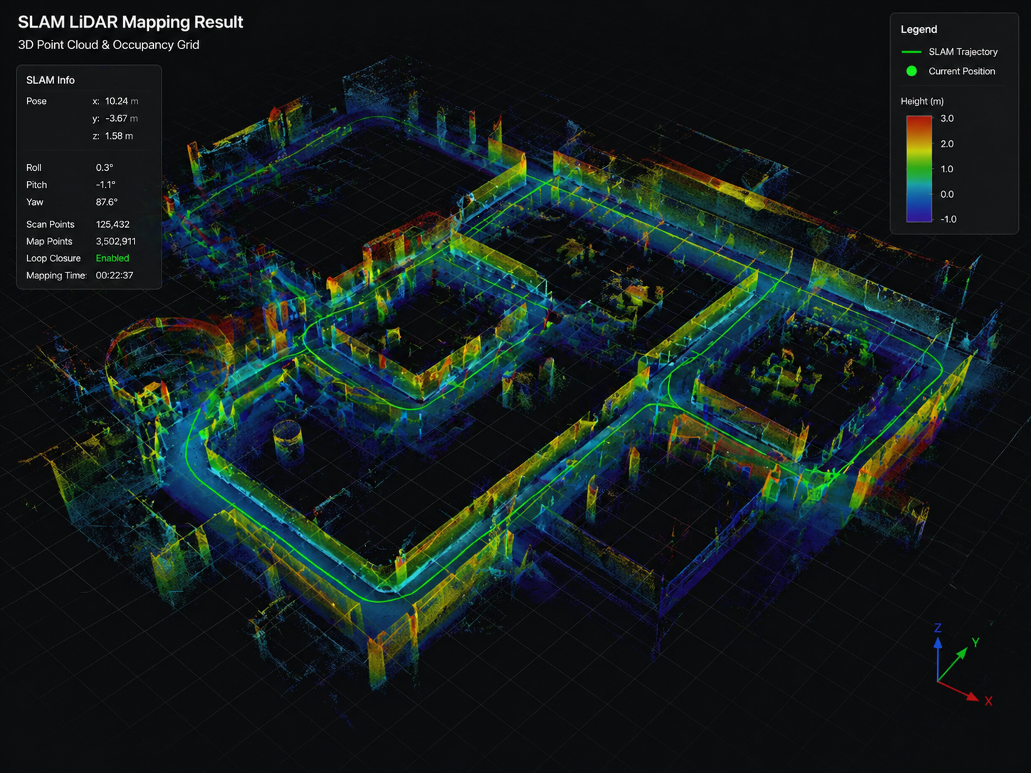
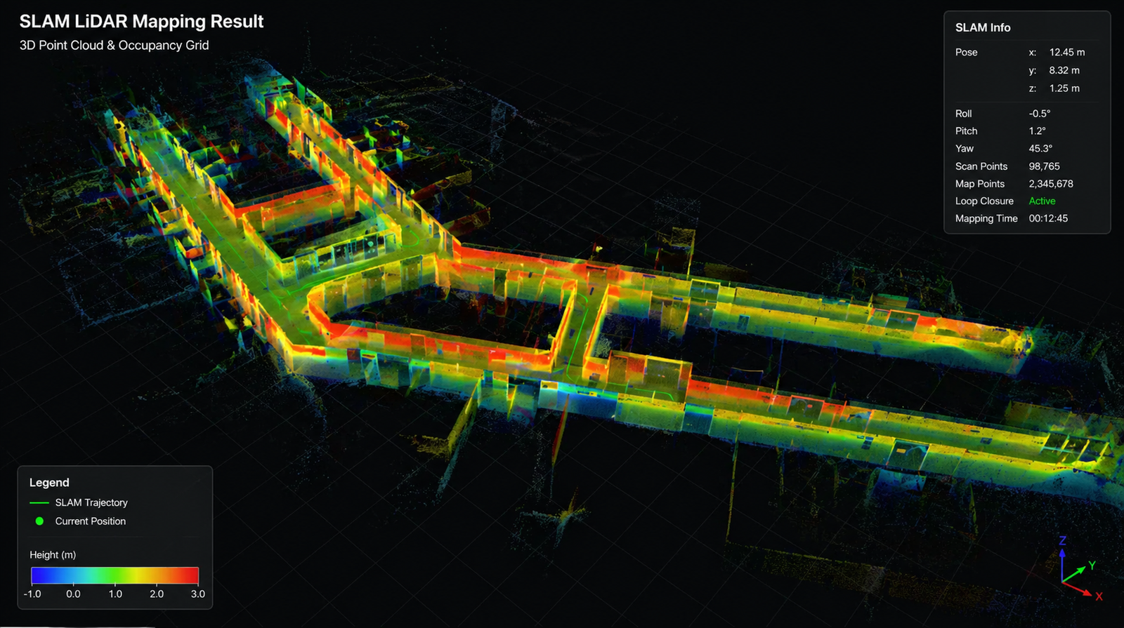
3D Point Cloud
Detailed 3D point data representing the shape of objects and environments.
Trajectory / Sensor Path
Displays the movement path of the sensor throughout the mapping process.
Pose Data
Contains real-time sensor position and orientation information.
3D Mesh
3D surface model reconstructed from the surveyed object or area.
3D Model
Three-dimensional digital visualization for analysis and presentation.
Orthophoto
Geometrically corrected imagery produced from the mapping process.
Sample Output
Our Commitment
We are committed to providing accurate, fast, and high-quality SLAM LiDAR services by utilizing modern 3D mapping technology and experienced professionals. We ensure that every data acquisition and processing step is carried out optimally to produce detailed, precise, and reliable spatial information.